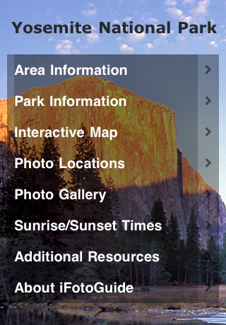
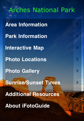
My photography has transformed over the past couple of years thanks in part to the advent of photography apps on the iPhone. Reference information, in particular, now available on iPhone apps has made a special impact. My iPhone now is a critical photography tool when I’m in the field. Always on the look out for great apps I thought I’d share a review of an app series iFotoGuide (iTunes link) put together by fellow nature and landscape photographers Dan Baumbach and Bret Edge.
The iFotoGuide to date is comprised of location guides for Yosemite National Park and Arches National Park. Each offer information resources covering:
- Area Information
- Park Information
- Interactive Map
- Photo Locations
- Photo Gallery
- Sunrise/Sunset Times
- Additional Resources
 |
 |
Yosemite National Park iFotoGuide |
Arches National Park iFotoGuide |
Things I Liked and Didn’t Like
These apps have you covered when it comes to making plans to photograph these national parks. With in the “Area Information” section for example you have airport, transportation, lodging, campground, shopping, restaurants weather and important phone numbers at your finger tips. One noted absence that surprised me under “important phone numbers” was the lack of inclusion of regional resources to get road conditions. For example in the Yosemite app the CalTrans Highway Information number was missing to track when mountain pass roads are open/closed through Yosemite.
Weather information for each park is included in their respective app. Note that the “Weather” section will jump you to monthly averages. To get current conditions the app with an additional link will load Yahoo weather. Perhaps a personal preference I think I’d rather get the current weather first and click through to the monthly averages.
The Yosemite app includes a link to the Yosemite Cam page that loads with in the application. It’s just not possible to get enough of the Yosemite cams (unless you’re checking at night).
The Park information section covers the basics with wildlife, wildflowers, backpacking info and safety info. While the wildlife and wildflower sections are more than adequate it would be great to see in future versions more detail to fauna and plants species in each area.
The Interactive Map is a great feature allowing you to see example photos taken from various park locations. Small camera icons have been transposed to National Park maps so with a touch of your finger you can load photos to get an idea of what is possible. Each image on the Interactive Map loads with additional links to more detailed information and maps. The downside to the Interactive Map is that it’s impossible to do each park justice with the number of locations to photograph, but it does cover the major locations.
The Photo Gallery section also allows you to easily navigate additional information and maps. One thing that was mildly disorienting is that this section is a mixture of photos referencing subject and location. For example in the Yosemite app you might click a photo of Half Dome to read about a particular meadow and another photo of the same subject might tell you about Half Dome itself. Perhaps in future versions they’ll tighten this up to easily search of a quick means of seeing one or the other with in the gallery section.
The Photo Locations section does a great job of identifying photo subjects that are ideal to photograph at sunrise, sunset or all day. If you don’t have time to adequately scout these parks in advance this feature will prove to be a huge time saver.
The Sunrise/Sunset section of each app will give you a quick look at approximate times for sunrise and sunset for the 1st and 15th of each month. Helpful for general information it would be nice if the apps provided links that took you to a site that relayed specific information for a particular day. To be fair though this chart is more than enough if you lack connectivity in the field.
| Rating: |  |
iFotoGuide is well worthy of picking up for the price. For a version 1.0.x app it’s very well done. Easy to navigate, intuitive and full of great information. Some portions of the app aren’t as strong as others, but that’s normal. One app can’t do it all. On that note I’ll likely continue to use other applications that specialize in sunrise, sunset, moonrise and moonset calculations. I’m hopeful that in future releases more detailed information is added about wildlife and plant species. I’m eagerly awaiting to see what National Parks they add to the series next. For updates and additional information visit the iFotoGuide blog.

Pingback: Links – March 19, 2010 « Beautiful Flower Pictures Blog: Floral Photography by Patty Hankins